

Iterative Watershed Planning
A practical framework for coordinating watershed-wide flood management and improving it through monitoring.
Plan Across the —and Adapt
Why plan across a ?
A is the area of land that drains to a shared outlet. Water does not stop at property lines or jurisdictional boundaries, so an action upstream can affect flooding and water quality downstream. Planning only where flooding is most visible can miss causes or opportunities elsewhere in the . A approach coordinates actions across these connected areas and adapts as new information becomes available.
A planning process that learns
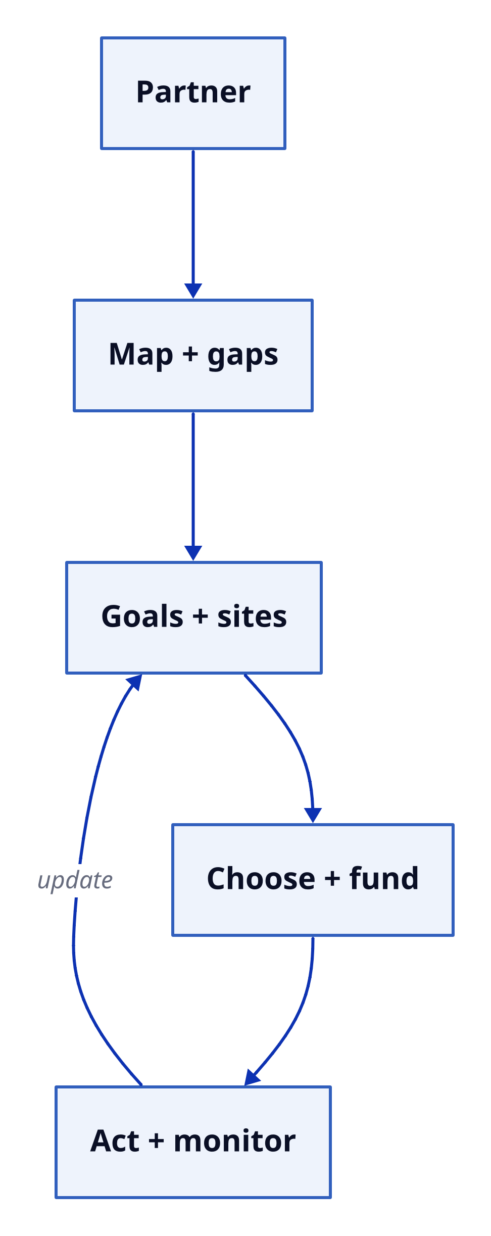
Planning brings people together, builds a picture of the , sets measurable goals, matches actions to local conditions, and checks results. It is iterative: monitoring can show that priorities or measures need to change, prompting another round of assessment and decisions.
Text description
An iterative watershed-planning cycle Five boxes run downward: Partner; Map + gaps; Goals + sites; Choose + fund; Act + monitor. A return arrow runs from Act + monitor to Goals + sites. Layout: down. Partner Map + gaps Goals + sites Choose + fund Act + monitor Partner → Map + gaps Map + gaps → Goals + sites Goals + sites → Choose + fund Choose + fund → Act + monitor Act + monitor → Goals + sites (update)
Start by building partnerships with residents, local governments, utilities, landowners, emergency managers, and other relevant groups. Then characterize the : map drainage areas, streams, floodplains, land cover, soils, slopes, infrastructure, past flood locations, and exposed people and assets. Note data gaps rather than assuming the picture is complete.
Use that assessment to set measurable goals—for example, reducing peak runoff, protecting critical facilities, or restoring floodplain storage—and identify where actions could reduce risk effectively. Match measures to local causes and conditions. Assign responsibilities, timelines, maintenance duties, and funding so the plan can be carried out. After implementation, track flood impacts and indicators such as runoff, stream levels, and the performance of drainage or green-infrastructure features. Use the results to revise priorities and actions.
Worked source example: Suppose an assessment finds that upstream pavement sends runoff quickly into an undersized culvert. The reasoning is to address connected causes and effects, rather than treating the flooded neighborhood alone: combine upstream detention and rain gardens with floodplain protection, culvert maintenance, and warnings. Then monitor later storms. Those observations help planners judge how the combination is working and what to adjust; the plan does not assume in advance that every measure will be sufficient.
: A repeated planning process in which results are used to update priorities and actions.